Pyhtää (Pyttis)
 |
The municipality has a population of 0 and covers an area of undefined km2 of which undefined km2 is water. The population density is undefined PD/km2.
The medieval church (as opposed to the municipality) is situated in the village of Itäkirkonkylä ("East Church Village"). During the Reformation, the rather beautiful and moving pictures on the walls were whitewashed over. Some years ago, they were rediscovered and the whitewash removed. The village lies just to the East of the westernmost tributary of the Kymi River and was at one time on the border between Russia and Sweden established by the Treaty of Åbo in 1743. Indeed, on the Western side of the river is a municipality called Ruotsinpyhtää ("Swedish Pyhtää") known as Strömfors in Swedish.
The municipality is bilingual with 0 speaking Finnish, 0 Swedish and 0 other languages as their first language.
In the 1980s, salmon soup, salted herrings and clot soup (klimppisoppa) were named as Pyhtää's traditional parish dishes.
Map - Pyhtää (Pyttis)
Map


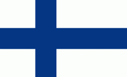
Country - Finland
 |
 |
| Flag of Finland | |
Finland was first inhabited around 9000 BC after the Last Glacial Period. The Stone Age introduced several different ceramic styles and cultures. The Bronze Age and Iron Age were characterized by contacts with other cultures in Fennoscandia and the Baltic region. From the late 13th century, Finland became a part of Sweden as a consequence of the Northern Crusades. In 1809, as a result of the Finnish War, Finland became part of the Russian Empire as the autonomous Grand Duchy of Finland, during which Finnish art flourished and the idea of independence began to take hold. In 1906, Finland became the first European state to grant universal suffrage, and the first in the world to give all adult citizens the right to run for public office. After the 1917 Russian Revolution, Finland declared independence from Russia. In 1918, the fledgling state was divided by the Finnish Civil War. During World War II, Finland fought the Soviet Union in the Winter War and the Continuation War, and Nazi Germany in the Lapland War. It subsequently lost parts of its territory, but maintained its independence.
Currency / Language
| ISO | Currency | Symbol | Significant figures |
|---|---|---|---|
| EUR | Euro | € | 2 |
| ISO | Language |
|---|---|
| FI | Finnish language |
| SV | Swedish language |
